
Environment and Energy
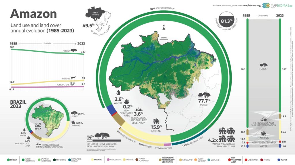
Amazon Agriculture Expansion and Forest Loss, 1985 to 2023
In Brazil's Amazon, farmland grew from 12.9 million hectares in 1985 to 66.6 million in 2023, mostly cattle pasture, while forest shrank from 380 to 327…

Infographic publisher
MapBiomas Brasil is a network of universities, NGOs and technology companies that produces yearly maps of land cover and land use across Brazil. It processes Landsat satellite images pixel by pixel with machine learning on Google Earth Engine, with a record going back to 1985, and gives its data away free to support conservation. Its chart on our site tracks farming expansion and forest loss in the Amazon.
In Brazil's Amazon, farmland grew from 12.9 million hectares in 1985 to 66.6 million in 2023, mostly cattle pasture, while forest shrank from 380 to 327…
Is this your work? Tell us about a credit, a correction or a better description, and we will update this page.
Give it a permanent page where people looking for your subject find it, with your name and a link to your site. Content marketers, agencies, designers and researchers all list here.